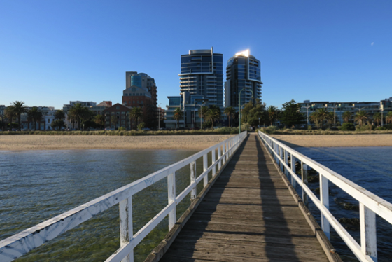
Now and Then 2021 – HMAS Apartments and Lagoon Pier
Completed in 2001, the HMAS Apartments were designed by the renowned architectural firm of Fender Katsalidis, who also designed Eureka Tower, Australia 108 and many other striking buildings. The towers of this apartment complex are visible from many parts of Port Melbourne.
The name reflects the history of the site which was the location of the naval base HMAS Lonsdale from 1940 until 1992. During the Second World War, thousands of recruits did their basic training here. Likewise, it was used for National Service conscripts during the 1950s.
The name reflects the history of the site which was the location of the naval base HMAS Lonsdale from 1940 until 1992. During the Second World War, thousands of recruits did their basic training here. Likewise, it was used for National Service conscripts during the 1950s.
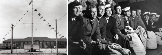
In 1982, the City of Port Melbourne granted the personnel of HMAS Lonsdale the Freedom of Entry to the City underscoring the close association between the Royal Australian Navy and the local community. Built in 1912, the former naval Drill Hall in Bay Street reminds us of the presence in Port Melbourne of the Navy since the time of its formation. The service of all Naval men and women in war and in peace is commemorated by the statue, Answering the Call, on the Port Melbourne foreshore opposite Dow Street.
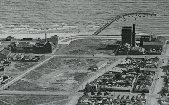
Lagoon Pier is a reminder of the small boat harbour that once extended from Hobsons Bay back to Rouse Street, the last remnant of the former Sandridge Lagoon. A young Henry Whatty frequently took pictures of boats and people enjoying themselves along the foreshore.
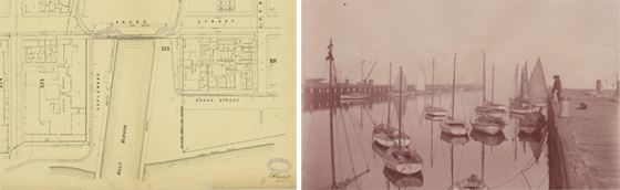
In the 1920s, the boat harbour was filled in and the land reclaimed leaving only the curved pier that provided a safe haven for small craft. Harper’s Starch Factory, now Sandridge Bay Towers, and onetime movie set, can be seen on the right with its distinctive chimney. This building, dating from the 1890s, was the first high rise tower on the Port Melbourne foreshore.
This article is based on one of the panels that formed the Now and Then Exhibition of the Port Melbourne Historical & Preservation Society in October 2021. The original panel can be seen here.
Corner Bay and Beach Streets | Now and Then 2021 | Albert and Alfred Streets