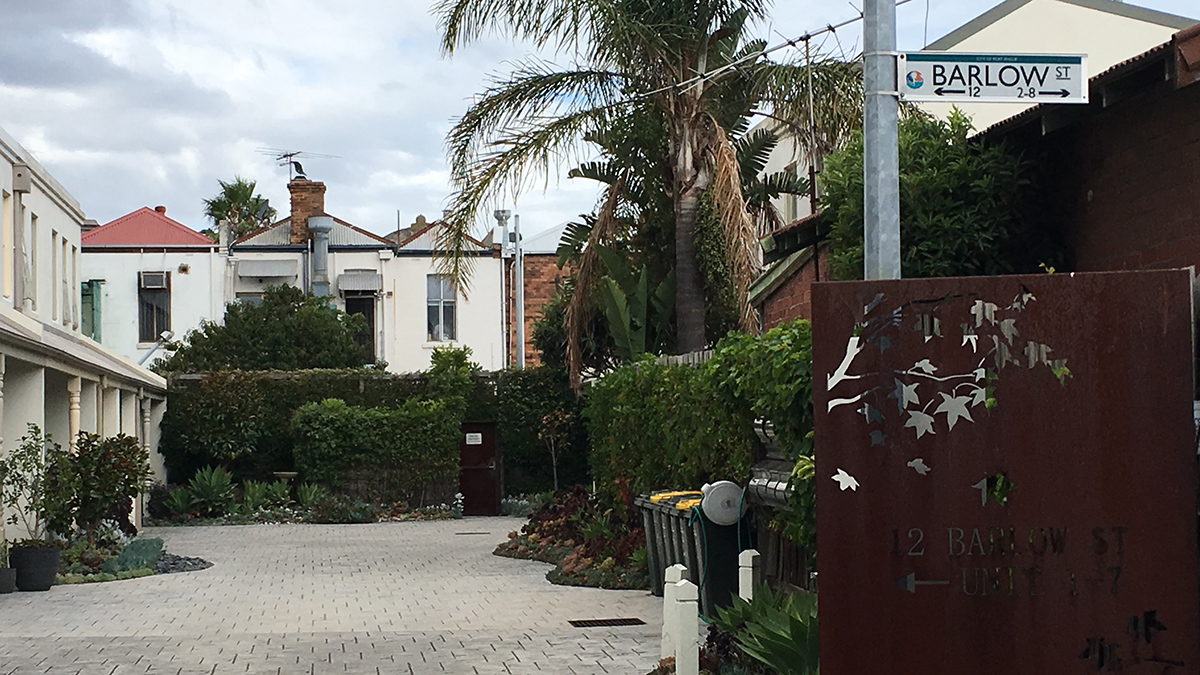
Barlow Street
by David F Radcliffe
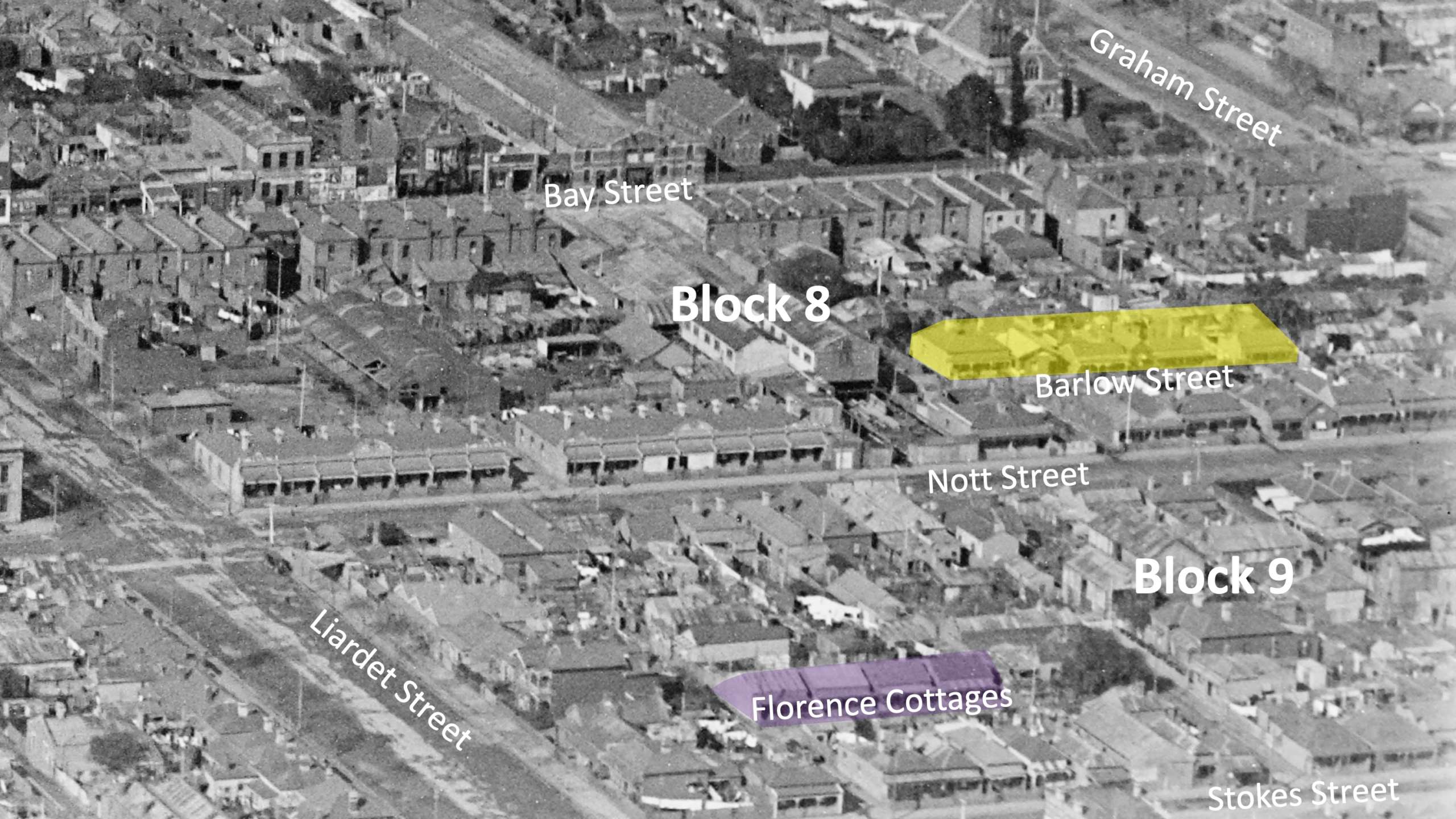
Barlow Street is one of those “internal” roadways that provide access to houses located off the main streets in Port Melbourne. Its entrance is on the eastern side of Nott Street between Liardet and Graham Streets.
Like Florence Place, Barlow Street is a consequence of the way land was subdivided into small building lots for houses and shops. Each of the city blocks in the southern part of Port is five acres. Block 8, bounded by Bay, Liardet, Nott, and Graham Streets was divided into quarter acre allotments (one rood) and auctioned off in late 1852 and mid-1853, the peak years of the population influx during the gold rush. The northern portion (2 acres) was set aside as a Market Reserve.
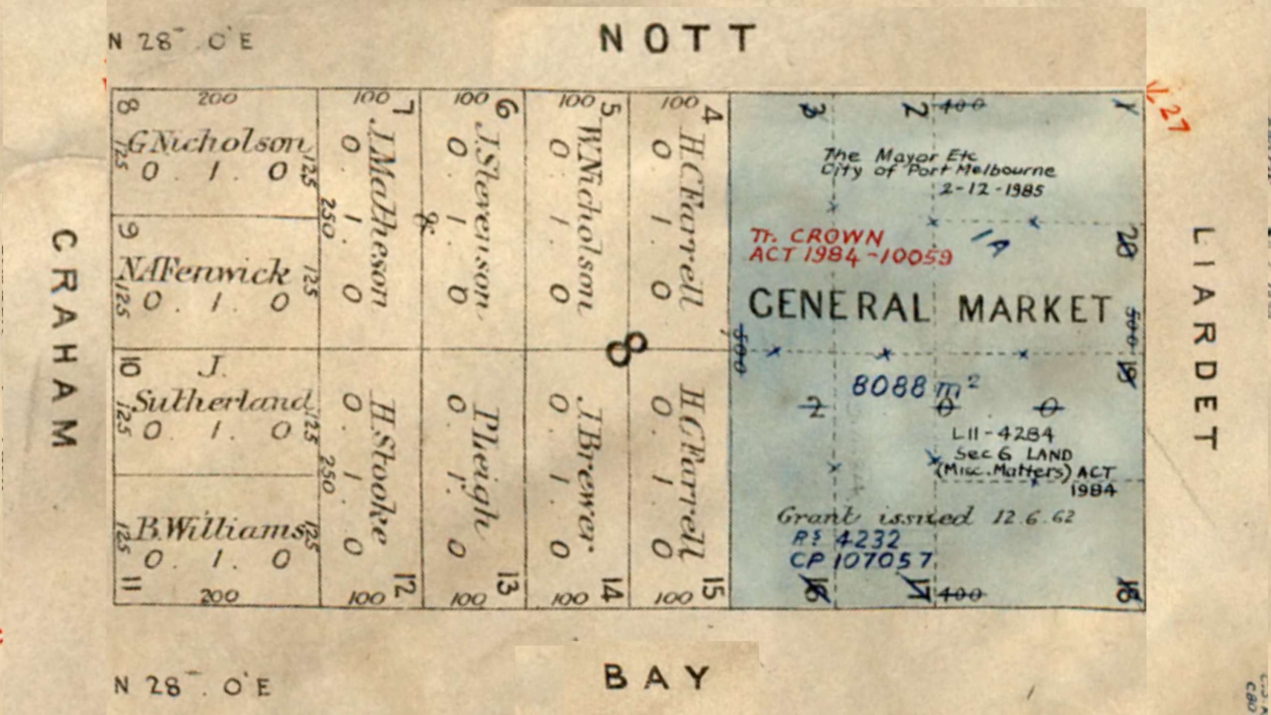
The five remaining allotments on Bay Street were soon subdivided into long, narrow building lots with houses and businesses appearing on them over the next decade. A right of way, later called Retreat Place, was formed to give access to the rear of these premises as well as a couple of houses erected at the back of allotments 13 and 14. The land in block 8 along Nott Street was developed during the 1860s. By 1863, allotments 5, 6 and 7 had each been subdivided into four or five building lots, with two or three of these fronting Nott Street. The remaining lots were located behind these, deep in the block, accessible from Nott Street via a right-of-way, which became known as Barlow Street. A portion of the land on Nott Street originally set aside for the market was developed in 1887 as Queens Terrace and Jubilee Terrace.
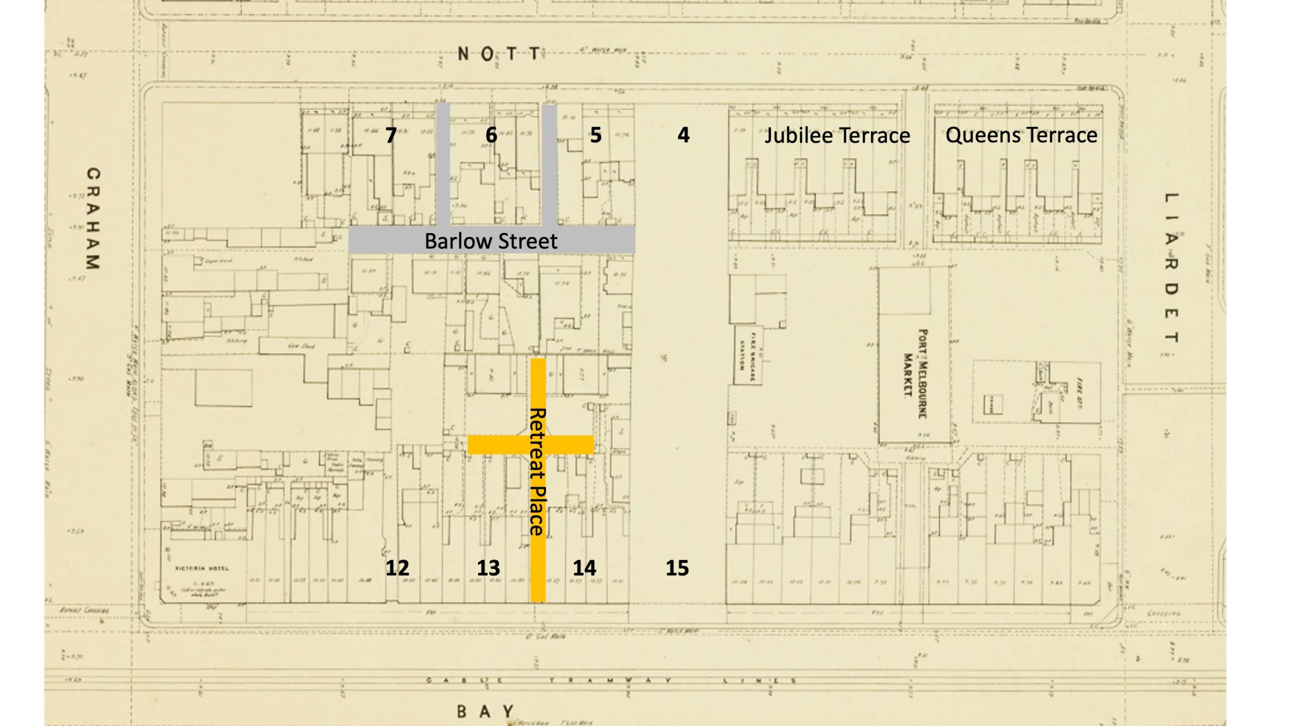
In 1865, William James Barlow rented a four-room wooden house on allotment 5 fronting Nott Street. A year later he owned it. By 1871, he owned four houses on allotments 5 and 7 as well as all of allotment 6 which was still vacant land. William and his growing family now lived in a brick house on the western side of Nott Street (block 9), directly opposite allotment 6. Barlow also owned and rented four small houses in block 9. He sold allotment 6 (block 8) in 1873. Barlow’s brother Richard lived in one of the Nott Street houses on allotment 7 and his brother-in-law, James Stivey (junior) owned a house on the right-of-way in allotment 5.
The name Barlow Street first appears in newspapers during the late 1880s. However, it remained an unofficial right-of-way until the Council constructed a sealed roadway on it in 1891.[1] This action was triggered by illness in the area due to poor drainage, an issue that residents had raised over a year earlier.[2] It was one of many rights-of-way built by the Council from the 1880s, paid for by the residents whose houses fronted them. Unfortunately, drainage continued to be an issue in Barlow Street as did the state of the road surface with residents petitioning the Council in 1897[3], 1904[4], 1915[5] and again in 1929[6] for improvements to be made.
But the story of William James Barlow, and his family, extends well beyond the formation of Barlow Street.
Continue reading about the Barlow family in William and Christiana Barlow.
[1] 1891 ‘Port Melbourne Borough Council.’, Standard (Port Melbourne, Vic.:1884 – 1914), 18 July, p. 3., viewed 16 Mar 2023, http://nla.gov.au/nla.news-article164430935
[2] 1890 ‘Port Melbourne Borough Council’, Standard (Port Melbourne, Vic.:1884 – 1914), 29 March, p. 4., viewed 16 Mar 2023, http://nla.gov.au/nla.news-article164425016
[3] 1897 ‘Town Council.’, Standard (Port Melbourne, Vic.:1884 – 1914), 28 August, p. 3., viewed 27 Mar 2023, http://nla.gov.au/nla.news-article165312503
[4] 1904 ‘Town Council.’, Standard (Port Melbourne, Vic.:1884 – 1914), 25 June, p. 3., viewed 27 Mar 2023, http://nla.gov.au/nla.news-article164432768
[5] 1915 ‘Level of Barlow Street.’, Port Melbourne Standard (Vic.:1914 – 1920), 6 February, p. 2., viewed 27 Mar 2023, http://nla.gov.au/nla.news-article91163803
[6] 1929 ‘Port Melbourne Council’, Record (Emerald Hill, Vic:1881 – 1954), 31 August, p. 8., viewed 27 Mar 2023, http://nla.gov.au/nla.news-article164965799