Skip to content Skip to footer
Town Hall, 333 Bay Street, Port Melbourne

Church Street

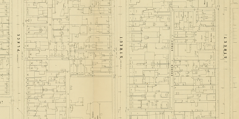
Church St (highlighted), MMBW Map (detail), 1895. State Library of Victoria Church Street is the Z-shaped laneway running from Stokes Street to Nott Street highlighted above on an MMBW map from 1895. St Joseph's Roman Catholic Church, MMBW Map (detail), 1895. State Library of Victoria. The Stokes Street end of Church Street is opposite St Joseph's Roman Catholic Church which was…

Read more

PMHPS acknowledges the generous support of the City of Port Phillip.


The content of this site (images and text) must not be reproduced in any form without the prior consent of PMHPS or the copyright holder.

Acknowledgement of Traditional Custodians

We respectfully acknowledge the Traditional Custodians of the land on which we meet and work, the Bunurong Boon Wurrung and Wurundjeri Woi Wurrung peoples of the Eastern Kulin Nation and pay respect to their Elders past, present and emerging.