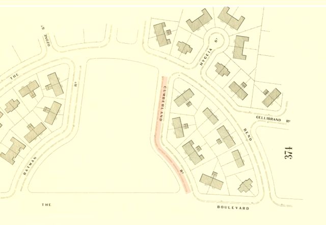
Cumberland Road
by David F Radcliffe
Cumberland Road is one of a pair of curved streets that form the ‘entrance’ to the Fishermans Bend Estate. The other is Batman Road. Both run off “The Boulevard”, the bayside boundary of this estate conceived in the late 1930s to provide decent housing for working people. Both streets allude to the early European history of this place.
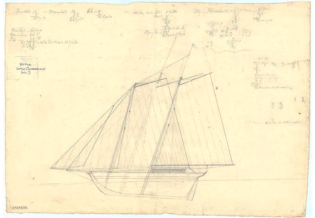
The name Cumberland derives from Her Majesty’s Colonial Ship (HMCS) Cumberland, the vessel that acting Surveyor General for the Colony of NSW, Charles Grimes, travelled on to investigate the suitability of Port Phillip as a location for a future settlement. Built in Sydney in 1801, the little Cumberland was a two masted schooner of just 29 tons.
The first Europeans to enter the bay, initially called Port King and later Port Phillip, were aboard the HMS Lady Nelson in February 1802. A few months later Mattthew Flinders, on board the HMS Investigator, conducted a survey of the coastline of the bay.[1] The Grimes survey, in January and February 1803, on the Cumberland included time ashore during which they came across the river we know as the Yarra and a large saltwater lagoon (Sandridge Lagoon). The journal entry for Wednesday 2nd February 1803 made by James Flemming, a gardener who was on the Grimes expedition reads.
…. for about a mile the land dry, a light sandy soil; afterwards a large swamp, with three lagoons in it, all dry. The land appears to be covered with water in wet seasons. Came to a salt lagoon about a mile long and a quarter of a mile wide; had not entrance to the sea. Soon afterwards came to a large river went up it about a mile when we turned back and waited for the boat to take us on board. The ground is a swamp on one side and high on the other. Saw many swans, pelicans, and ducks.[2]
In a strange twist of history, Matthew Flinders travelled on the Cumberland on his return to Britain late in 1803. Originally, he departed on the HMS Porpoise but after she struck a reef and sunk, he ended up on the Cumberland. She was not very seaworthy, so they put ashore at French-controlled Mauritius off East Africa for repairs. Unfortunately, France and Britain were back at war, so Flinders was detained, suspected of being a spy.[3] He spent the next seven years there before the British took control of Mauritius, in December 1810, freeing Matthew Flinders and taking back control of the Cumberland.
[1] https://www.eoas.info/biogs/P007184b.htm
[2] John J. Shillinglaw (ed), Historical Records of Port Phillip: The Annals of the Colony of Victoria, Government Printer, Melbourne,1879, pp. 26-27.
[3] H. M. Cooper, ‘Flinders, Matthew (1774–1814)’, Australian Dictionary of Biography, National Centre of Biography, Australian National University, https://adb.anu.edu.au/biography/flinders-matthew-2050/text2541 , published first in hardcopy 1966, accessed online 28 April 2025.