A Plan for a Fence
by David Thompson
The PMHPS Collection includes a number of plans and some of the older ones – the ones from the Sandridge days – are works of art.
Take, for example, Cat No. 88 – Elevation of Proposed Fence to Station Place Reserve.
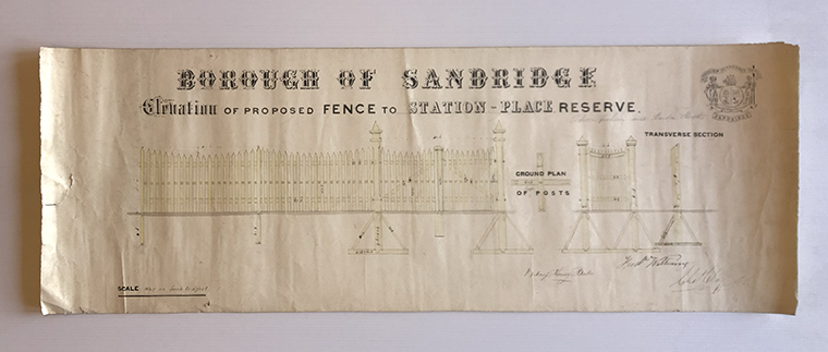
The first thing you notice is the beautiful calligraphy in the headings but the hand-drawn rendering of the fence, at a scale of half and inch to a foot, is detailed and exquisite.
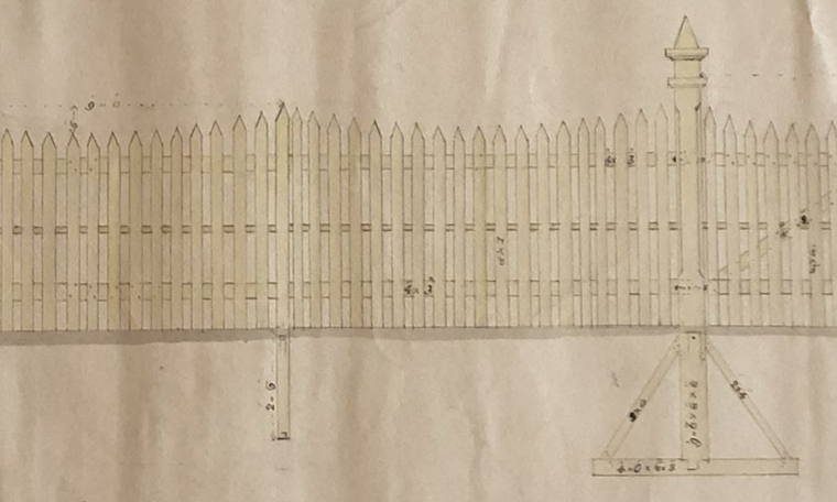
The plan includes the front elevation, transverse section of the fence and the ground plans of the posts.
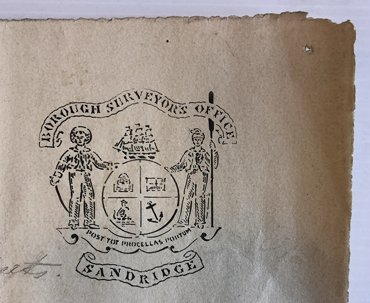
The top right corner bears the crest of the Borough Surveyor’s Office consisting of the familiar Borough of Sandridge crest incorporating the name of the office.
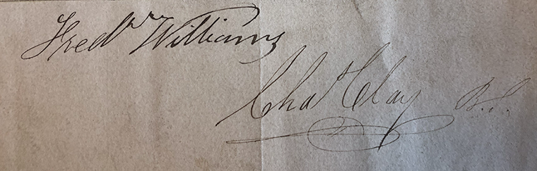
The plan is signed by Witney Henry Bates, Fred Williams and Charles Clay. Charles Clay was the Borough’s first surveyor and held the position from 1860 until his retirement, due to ill health, in July 1884. Fred Williams was an architect who designed several buildings in Port Melbourne including The Graham Hotel but also served on Council from 1875 to 1886 including one term as Mayor in 1880/81. The role of Witney Henry Bates is not known although it is possible it is his handiwork that we are admiring today.
The plan is undated but presumably Frederick Williams was involved in has capacity as Mayor dating it to 1880/81.
You won’t find Station Place on a map of today but it was the original name of Station Street. A note, in pencil, beneath and to the right of the heading indicates that the fence was between Graham and Bridge Streets.
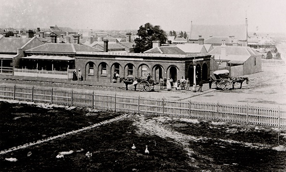
The photograph of the Station Hotel below shows a less ornamental, earlier, fence at the corner of Station Place and Bridge Street in the 1870s and with geese running loose, perhaps shows the reason why the reserve would need to be fenced in the first place.
Sources
U’Ren, N. and Turnbull, N., 1983. A History Of Port Melbourne. Melbourne: Oxford University Press.
1884 ‘MUNICIPAL INTELLIGENCE.’, The Argus (Melbourne, Vic. : 1848 – 1957), 4 July, p. 3. , viewed 12 Aug 2022, http://nla.gov.au/nla.news-article6052630